
Kinder Scout
- Aug 21, 2020
- 10 min read
The peak that was never reached … yet..
Even though it is the highest ground in England, south of Yorkshire Dales, it is not a classic, sharp pointed hill. Kinder Scout stretches for 39 km2 (15sq miles) and is more than a plateau than a peak. Parts of the trail have been reconstructed in 1980’s by National Trust and now it is part of the Pennine Way trail. However, what makes Kinder Scout really special are the amazing rock formations scattered all over the trail and fantastic views of the surrounding hills.

Good news is that once you have completed the ascent that is it. The ground level at the top differs only by few meters so you can relax while enjoying the views. The full trail is about 18 miles long, however, you can complete only sections of it, depending on how much time or energy you have.

There are 2 main starting points for the walk. The shortest option is to start at the lovely village of Hayfield (car park SK22 2LH) and move towards the Kinder Reservoir. Once you have passed it, carry on straight until you reach the crossroads and take the Pennine Way trail (on your right). Go past the Kinder Scout Charged Rock and after a short while you should reach Kinder Downfall. You can take a small detour and visit a small tarn called The Mermaid’s Pool. Legend has it that if you visit the pool on Ester Eve you would see a beautiful mermaid there and you will be granted a gift of eternal life.

After walking past Kinder Downfall, follow the path South towards Kinder Scout and then Kinder Low and then take the path back to Hayfield, going past the Edale Cross (close to Jakob’s Ladder). The full circle is about 10 miles long and should take you about 4 hours. Unfortunately, as for now, I can’t tell you if the path is easy or difficult, as I have not travelled it myself yet. What I can tell you is that the other options definitely do require a steep climb and potentially a dangerous passage through some nasty bogs.

Let us focus on the paths starting form Edale now. There are a few parking options here. You can leave you car on the main car park close to the Edale Village Hall (S33 7ZA) which also does offer an access to public toilets. Unfortunately, it is rather small so finding a free spot might be tricky. Your next option is the train station car park just down the road, on the left. There are few spaced close to the station and few more if you drive straight past it. Usually you should be able to find some spaces there, however on a weekend, if the weather is nice, even this car park might be full. Then your last option is a charity car park located in one of the fields nearby. Go back to the main Edale Road and turn right. After 0.3 mile take the right turn and you are there. It is the biggest and cheapest parking in the area, with a very unconventional paying option. At the gate there is an old milk canister where you insert 5 pounds for a whole day or 3 pounds if you arrive after 3pm (GPS 53.361988,-1.821701).

Now you need to reach the Rambler Inn. A great place to enjoy some food and a pint on the way back. From the field car park turn left and follow the footpath leading to the train station. Walk past the Penny Pot Café, merge with the main road and again turn left. Both, the Penny Pot Café and Rambler Inn serve vegan options, so if you travel with a bigger group, everyone should find something they can enjoy. Walk Past the Rambler Inn and the Edale Church and keep walking until you have reached the Old Nags Head. This is your starting point for all trails. You can turn left, towards the Pennine Way or carry on straight until you have reached a sign on the right pointing towards Grindsbrook. If you chose the second option then again you can either walk the full trail via Ringing Roger or skip that one hill and follow the main path, running alongside Grinds Brook towards Grindsbrook Clough.

Option 1 via Ringing Roger

As I have mentioned above, in both cases, Ringing Roger path and Grindsbrook path, you need to walk past the Old Nags head and turn right from the main road by the ‘Grindbrook’ sign. You should see a well prepared descend towards the Grinds Brook footbridge hidden between the tall trees. Cross the bridge and follow the main, stone path. Soon should be able to see the Ringing Roger and all other peaks of the trail.


Take the footpath to the right, leading towards the gate. The path is in decent condition, and is not as steep as the Jacob’s Ladder or tricky like Grindsbrook path. At the bottom of the hill you will have to climb quite a few stone stairs which later level slightly and change into a regular stone footpath.

The walk is rather pleasant and to be honest only the last 100 meters might prove to be a bit more challenging as you will need to find your way through some scattered rocks. Additionally, the last section is also quite steep so definitely take your time while heading toward the summit. You might need to use your hands, every now and then, for some extra support.

Even though it is the lowest of the peaks if is definitely the most rocky and pointy one out of them all. Afterwards simply stick to the main path which should eventually lead you to ‘The Mushroom’ at the top of Grinsbrook Clough (merging with the path alongside Grinds Brook). If you chose this path you should definitely start your walk early in the morning as completing a full circle will take you most of the day.

Option 2 The Grinds Brook path
Personally, I find this to be the most interesting path. The whole path was shaped more by the water and hikers rather than National Trust workers. It is perfect for the summer but might be difficult to cross after few days of rain. In 2019 we have followed this path and managed to create a video from that trip so feel free to join us on our excursion by clicking the link below.
This route follows Grinds Brook, which is part of the river Noe, and very frequently you might be forced to cross small streams and walk on wet, loose rocks which is not an ideal option. As in case of the Ringing Roger path, you need to cross the Grindsbrook footbridge but this time stick to the main trail.

Follow the stony footpath until you reach the gate to a lovely, small forest.

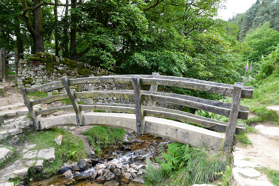
Go through another gate and cross the most adorable footbridge you have ever seen and follow the main path to the left. It is a narrow but very pleasant path which gives you the opportunity to enjoy the views. While taking this rout, especially at the end of July, you can admire the beautiful, purple heathers scattered on the green hills, amongst the numerous, small waterfalls and rock formations.

Here it starts to be a bit more tricky as the path is covered with large stones ad boulders and you will need to find your way through them. Additionally, you will need to walk through water, so waterproofs are essential. Personally, I had to use my hands for additional support most of the time as I am quite short and would struggle to keep my balance otherwise.

In terms of navigation – stick to the river until you have reached a place that looks like and avalanche of stones would have come down from the hilltop. This is your new path to the top.

Compared to the Jakob’s Ladder it most certainly is less safe, as there are a lot of loose rocks and frequently it is difficult to find a place to put your foot down but it is more interesting and does not put all the strain on your legs as you can use your hands to pull yourself up every now and then. Yes, it does wear you out and it is steep but from all 3 options this is the one I have enjoyed the most.
At the top you should get a good view of the whole plateau. You should also be able to see the ‘Mushroom’ on your left, since that is the stop where the paths merge. Here you need to choose wisely which way you want to go. The route closest to the ‘Mushroom’ stone, to the left, will lead you back to Edale. The path you want to take is the one paved with massive slabs (if you are using your compass it should point to the East).


The first formation of rocks that you should encounter will resemble a bunch of seals (well at least it did to me) and the second one I called the Ogre’s head (which again I am almost certain is not the correct name of that rock). Stick to the main path until you have reached the famous Pig’s Head (this time it actually is the official name).

This will mean you are more or less half way through this section and soon you will be faced with a choice – follow the way toward Crowden Tower and Wool Packs or turn right and cross the bogs/wetlands towards Kinder Downfall. In any case, should you choose to find Kinder Scout, will require a cross country walk through the moorlands. So far neither myself or my close friends haven’t made that attempt yet.

Bear in mind that this will not be an actual peak and is more or less on the same level as everything around you, so it is very easy to miss it. My best advice is, having the Crowden Tower to your right, keep going West and eventually you should reach it. The path through the bogs is more in the North-West direction. For obvious safety reasons, do not attempt to cross the wetlands after heavy rain.


The ground is very soft, wet and even in the summer it is sometimes challenging to cross. Additionally, a map and a compass are the bare minimum you should have on this route. We have used one of the offline navigating apps and I must say it did get us through without major issues. First you will need to stick to the Crowden Brook, then fight your way through the pits and marshes until you will reach the Kinder River. That will then lead you without any major problems to Kinder Downfall and on the Pennine Way.

Option 3 Pennine Way
This is the most official trail of the route. As I have mentioned before, the section from Edale, through Jacob’s Ladder and all the way to Kinder Downfall, is part of the Pennine Way. It is the first National Trail, witch a lovely nickname ‘Daddy’, and is 431km long!

Going back to the Old Nag’s Head, just few meters away from the pub, on your left side, you should see the ‘Pennine Way’ sign. Follow the path through a little forest until you have reached another sign which will point you to the left. It starts nice and easy, with a stroll through the fields, amongst the adorable cows and sheep.

If you are travelling with your dog, please keep him on the lead as the animals get scared very easily and the last thing you need is a cow herd charging your way. Stick to the stone footpath and enjoy the views. After passing few gates the landscape will slowly start to change and become more elevated. The path also becomes a bit more muddy with sections of a cross country hike. Don’t be alarmed, there is no way you will get lost here.

Keep going until you have reached a farm, next to another sign post, pointing you in the right direction. Walk through the farm yard and cross the bridge over Crowden Brook. This should lead you to the gate of Lee Farm, more sheep, and eventually to the adorable, straight out of Hobbiton, Yongate Bridge and Jakob’s Ladder. On a hot day, this spot is an absolute life saver, as you can cool off in the stream and rest a bit before the upcoming challenge. It is a truly enchanted spot, hidden between the hills.

When you stand at the bottom of Jakob’s Ladder, it looks rather innocent. You start to think ‘what was the whole fuss about? It’s just a staircase out of stones’.. Your opinion starts to change once you have reached 1/3 of it. The fact that you have to rely only on the strength of your legs, on such a long climb, makes it a difficult obstacle to conquer. Take your time, have a break halfway through if you need it, and keep moving forward. You will get to the top eventually. It may not be the easiest way but it is in a very good condition and quite safe.

Fun fact, the name Jakob’s Ladder goes back to the 17th century, when Jacob Marshall, a local pack horse trader, decided he wanted to transport his goods quicker than his competitors, and started using this section as a shortcut on his trade route.

Now, that you are almost at the top, follow the path until you have reached the Edale Rocks. Again, it is a nice, paved with stone slabs path, so you shouldn’t have any issues finding it.

And that is it folks. Now, regardless which option you have chosen, you are at the top. You can either visit only Kinder Low, skip the actual Kinder Scout and return via the path next to Pym Chair and Wool Packs or follow the pain path to Kinder Downfall and the return the same way.

Kinder Low is actually only 3 meters lower than Kinder Scout, and you do not have to fight your way through the moorland to reach it. It is also clearly marked by a trig pillar. It is 633 meters high and surrounded by great rock formations. This is one of those unusual situations where the actual highest point is not marked by a trig but a lower ‘summit’ is. For this reason many travelers mistake Kinder Low for Kinder Scout.

As to Kinder Downfall, it is a beautiful, 30 meter high waterfall.. which unfortunately in the summer turns in to a disappointing trickle. Usually, it is very windy in that spot and the rocks are slippery from the water, that sometimes gest even blown up by the wind instead of going down, so do take caution while hiking in the area. It is worth to remember that there have been fatal accidents there when people were trying to take a perfect shot on the edge of the drop and unfortunately fell. If you are an experienced hiker you might want to visit Kinder Downfall in winter, as the water turns into an amazing ice curtain on a cold day.


On your way back, if you want to cut the trail a bit short, you can take the path down, just before Grindbrook Clough. Stick to the main path and once you go past the Pig’s Head look for a small hill right in front of you. Once you have reached it, follow the path to the right.

Go past the gate and then you can either go straight or cut it a bit short and turn more to the left. However, be aware that you will need to walk down the grassy hill, with no clear path. You can see the whole valley in front of you, with few farms below, so as long as you are going downhill, towards these buildings, you are going in the right direction. Keep going until you have reached the same path through the small forest just outside Old Nags Head.


After doing a 10-mile circular route, through the swaps, hills, rocks and streams, I can tell you one thing – a pint of cold beer never tasted better than the one we had Inn Rambler Inn. Just sitting in the lovely, spacious beer garden and watching the sun slowly hiding behind the hills that you have conquered, was a true definition of bliss.

Great post! For anyone handling multiple links daily, a bulk url opener can be a real time-saver and improve efficiency.